High risk areas
The area you can be banned from is known as a high-risk area.
Under earlier legislation, high-risk areas were also known as designated areas.
When they can be declared
The declaration of a high-risk area is covered under section 210 of the Liquor Act 2019.
The Minister of Alcohol Policy may declare an area to be a high-risk area if:
- alcohol-related violence has occurred in a public place in the area which is in the vicinity of licensed premises
- the minister believes that banning notices and exclusion orders are a reasonable way of preventing or reducing the further occurrence of alcohol-related violence in the area.
Current high-risk areas
Under the law, the below precincts are all high-risk areas.
Darwin
Darwin - central business district (CBD)

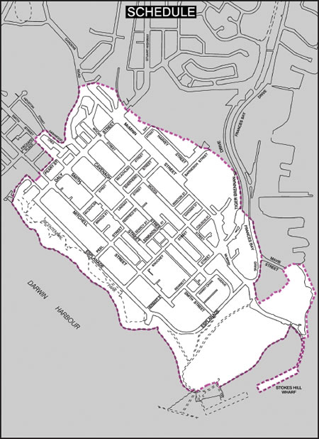
Above is a map outlining the Darwin CBD high-risk area.
This includes all areas within the boundaries of shoreline along The Esplanade and Kitchener Drive, Darwin Waterfront, Stokes Hill Wharf along to Mavie Street, along Frances Bay Drive and Tiger Brennan Drive, veering off past Barneson Street and along Harvey Street to Daly Street bridge, crossing the Stuart Highway and along McMinn Street to Hood Road, back along Gardens Road to Dashwood Crescent, into Houston Street and back along Smith Street towards the City, into Peary Street and down to Doctors Gully returning to the start of shoreline at The Esplanade.
Casuarina
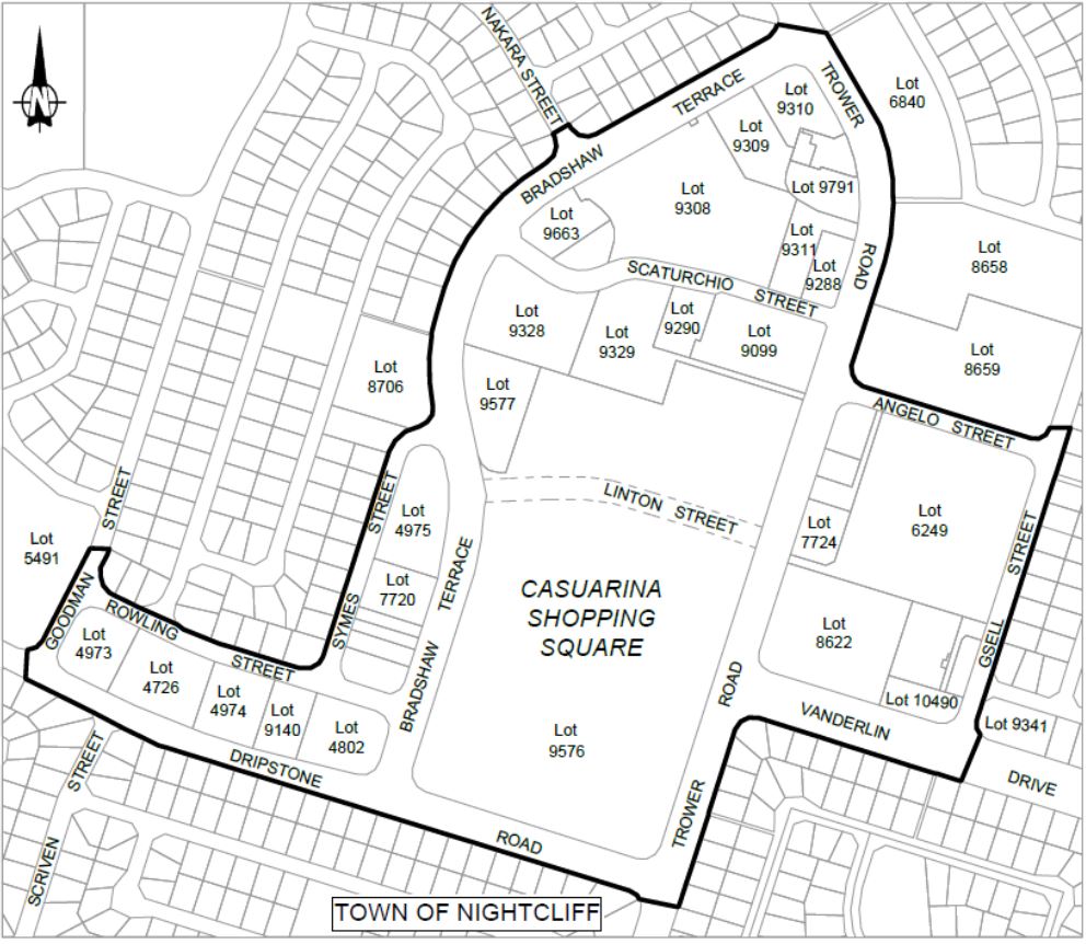
Above is a map outlining the Casuarina high-risk area.
This includes all areas within the boundaries of Rowling Street and Symes Street, along Bradshaw Terrace and Trower Road, along Angelo Street and Gsell Street, along Vanderlin Drive and Trower Road, along Dripstone Road and Goodman Street, then back to the junction with Rowling Street.
It also includes the Casuarina Library, Casuarina Village, Casuarina Plaza, Casuarina Swimming Pool, Casuarina Police Station and St. John Ambulance.
Other Darwin locations
Palmerston/Litchfield
Big Rivers
Katherine CBD

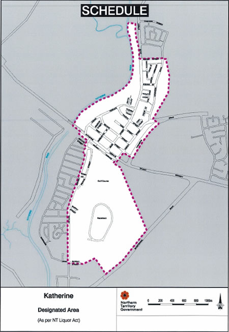
Above is a map outlining the Katherine CBD high-risk area.
This includes all areas within the boundaries of the junction of Giles Street and Cameron Street towards the Katherine River, along the edge of the river to Katherine Terrace, encompassing Giles Park and O'Shea Park, along Katherine Terrace to the Victoria Highway, along the Victoria Highway to Murray Street, continue along Murray Street joining up with the borderline of the Rodeo Arena and Showground at Bicentennial Road, follow the Rodeo Arena and Showground borderline up to Railway Terrace, across the Stuart Highway and along Lindsay Street to First Street, along First Street to Chambers Drive, continue along Chambers Drive to Lockheed Road, along Lockheed Road, including Lockheed Park on the right, to Rapide Street, along Rapide Street and Giles Street, returning to the junction of Giles Street and Cameron Street.
Barkly
Tennant Creek CBD

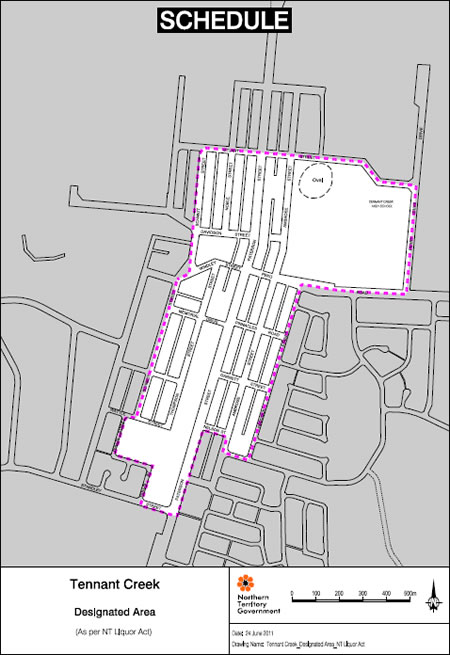
Above is a map outlining the Tennant Creek CBD high-risk area.
This includes all areas within the boundaries of junction of Stuart Street and Schmidt Street, along Schmidt Street to Wattle Street, along Hollis Street to Standley Street, from Standley Street to Paterson Street, along Paterson Street to Nelson Street, along Nelson Street and Ambrose Street to Staunton Street, along Haddock Street to Peko Road, along Peko Road to Perry Drive, including Purkiss Memorial Reserve, along Perry Drive to Stuart Street, along Stuart Street, crossing over the Stuart Highway back to the junction with Schmidt Street.
Central Australia
Banning notices
In the Northern Territory (NT), you can be banned by NT Police from certain areas if you do any of the following in a high risk area:
- cause alcohol-fuelled violence
- are involved in a crime
- display anti-social behaviour
- refuse to leave the premises.
The ban starts from the time the banning notice is received by the person.
A banning notice does not ban a person from all high risk areas in the NT, only the area for which the notice was issued.
Read about types of bans you can be given.
Give feedback about this page.
Share this page:
URL copied!
