Storm surge inundation
A storm surge inundation happens when a large storm, like a tropical cyclone, pushes a huge amount of seawater toward the shore.
The water can rise higher than normal tides and flood areas that are usually dry.
A tropical cyclone storm tide is a combination of a normal tide, along with the storm surge and waves created by the storm.
This can cause even more flooding and damage to coastal areas.
This includes damage to buildings, homes, and other infrastructure in coastal communities.
You should take storm surge warnings seriously and follow any evacuation orders for safety reasons.
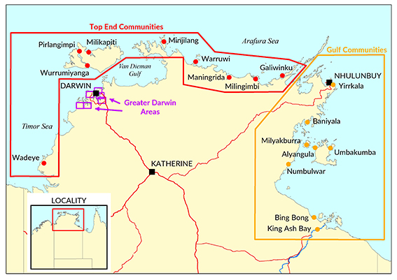
The maps below show which areas in Greater Darwin, the Gulf and Top End regions could be flooded by storm surges in the future.
These maps are based on estimates of how high the sea level might rise by the year 2100 and how often such floods could occur.

Greater Darwin areas
Greater Darwin storm surge inundation overview
Storm surge inundation areas mapped:
Gulf communities
Gulf communities storm surge inundation overview
Storm surge inundation communities mapped:
- Alyangula
- Baniyala
- Bing Bong
- King Ash Bay – Sheet 1
- King Ash Bay – Sheet 2
- Milyakburra
- Numbulwar – Sheet 1
- Numbulwar – Sheet 2
- Umbakumba
- Yirrkala
Top End communities
Top End communities storm surge overview sheet
Storm surge inundation communities mapped:
Resources
For more information about:
- storm surge, go to the SecureNT website.
- storm surge preparedness and safety, go to the BOM website.
Contact
For more information, contact Development Assessment Services on 8999 6046.
