

Marine habitat mapping
How marine habitats are mapped
Marine habitat mapping uses remotely sensed data, targeted direct sampling and development of models to predict where seafloor habitats are.
Maps are built from the ground up by describing the environmental conditions, then using statistical analysis and Geographic Information System (GIS) spatial modelling tools to map the environment into similar physical conditions.
This information is shown in a physical habitat map.
Based on this map, direct sampling techniques are used to characterise plant and animal species or communities at sampling sites in each habitat.
Statistical analysis of physical and species or community data for the sample sites lets spatial analysts use physical data to predict where plants and animals may occur in other areas not sampled (species/community habitat map).
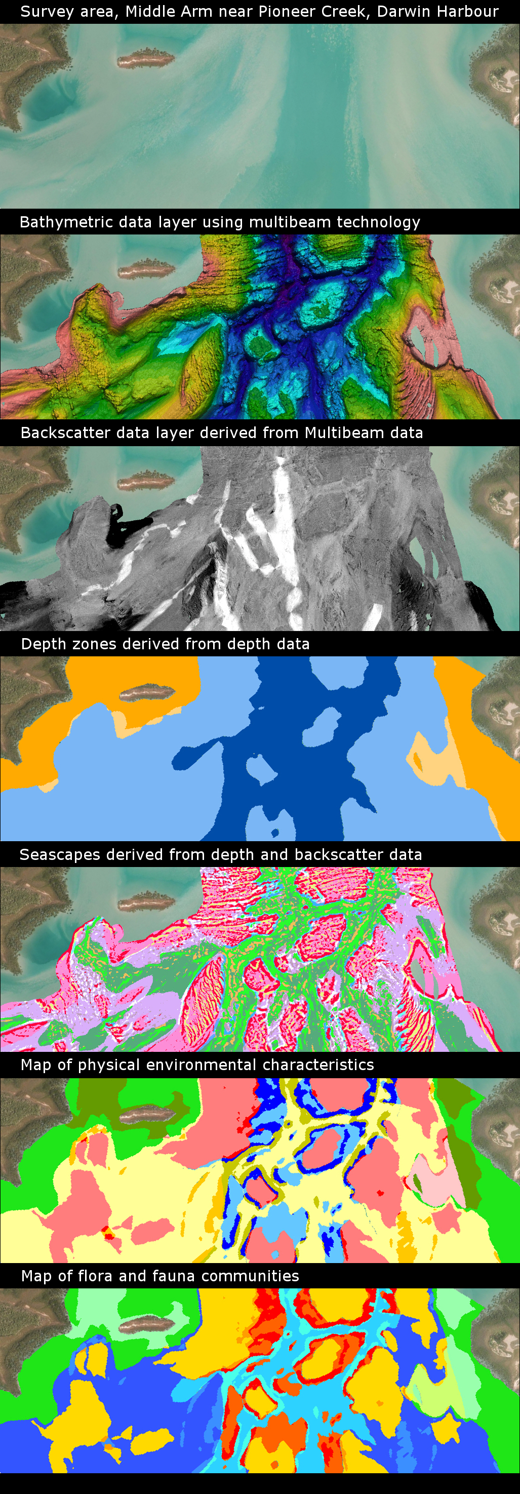
Types of marine mapping
These images show the different types of marine habitat mapping.
Marine habitat mapping tools
All of the following are examples of the tools used for creating marine habitat maps:
- remote sensing tools that use satellite imagery and/or aerial photography to map areas that are visible from the air
- remote sensing tools that use acoustic technology, such as multibeam echosounder systems to map the depth of the seafloor
- analysis of the strength of the return multibeam signal (backscatter) helps predict where it is likely that rock may occur
- water quality data, such as light availability at the seafloor, which helps predict where marine plants are likely to dominate
- modelling of depth and backscatter data will show what landscapes are present under the water
- modelling of all environmental data helps create habitat maps that have similar environmental characteristics
- predictive distribution maps can be created from modelling of species or community data with physical data.
Using the same methods, statistical analysis and GIS spatial modelling tools keep maps consistent, easy to update and improved when new data becomes available.
Print all pages in this section
Give feedback about this page.
Share this page:
URL copied!