

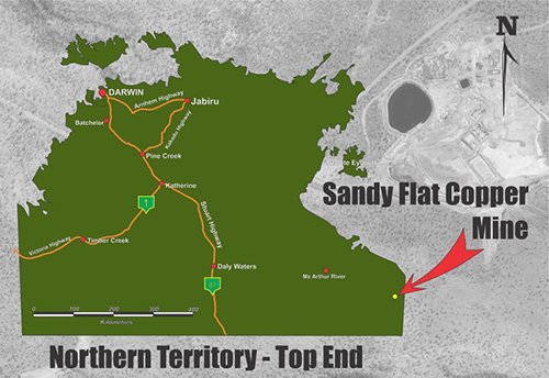
Sandy Flat Mine (former Redbank Mine)
Redbank is located in the Gulf region of the Northern Territory (NT) approximately 30km west of the Queensland / NT border and 70km inland from the Gulf of Carpentaria.
Hanrahan’s Creek and the Savannah Way run along the north western boundary of the site.
Mining activities at the site led to environmental impacts primarily caused by acid and metalliferous drainage (AMD), resulting in pollution of Hanrahan’s Creek.
History
Copper oxide was first discovered in the area in 1916.
Since then, the Redbank copper deposits have been worked intermittently.
The activity which is responsible for the current environmental impacts predominantly occurred between 1994 and 1996.
This included:
- mining from the Sandy Flat Pit
- processing to produce copper concentrate.
Read more about the history.
Cultural importance
Redbank and surrounding land are significant to the Traditional Owners.
A number of sites of significance are also known to exist along Hanrahan's Creek and further downstream.
The NT Government is working with Traditional Owners to provide a forum for stakeholders to be informed regarding activities at the site.
Read more about the cultural importance of Redbank Mine.
Remediation works
Remediation of this site is complex.
Extensive planning and consultation is required to identify the most appropriate remediation model.
A lot of studies have been completed to inform the remediation planning, including:
- waste characterisation and
- a conceptual hydrogeological model and water load balance model.
Read more about the remediation works and studies.
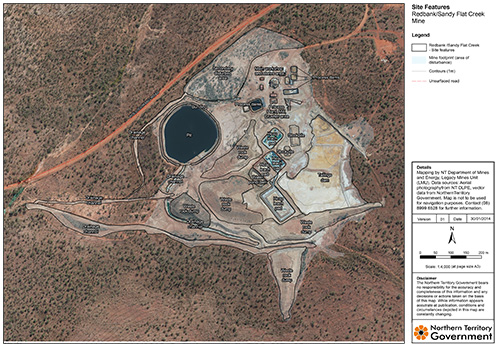
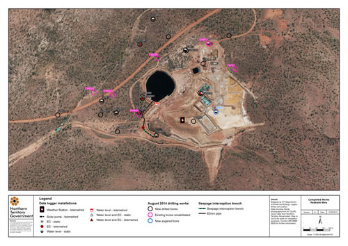
Site plans
Below are photos, downloadable site plans and a video of the site.
.")

.")
 at Echo Creek. (November 2003)")
 drain. (2004)")
")
")
")
")
")
")
")
")
")
")
")
")
")
")
")
.")
")
")
")
Aerial photos
.")
")
")
Watch the video below that shows a bird's-eye view of the site.
Contact
For more information, email legacy.mines@nt.gov.au.