Historical exploration and mining tenement maps
The historic exploration and mining tenement maps show the location of mineral titles across the Northern Territory (NT) between 1960 and January 2000.
More than 6,000 paper maps have been scanned as images, representing 40 years of mapping mineral titles across various map scales.
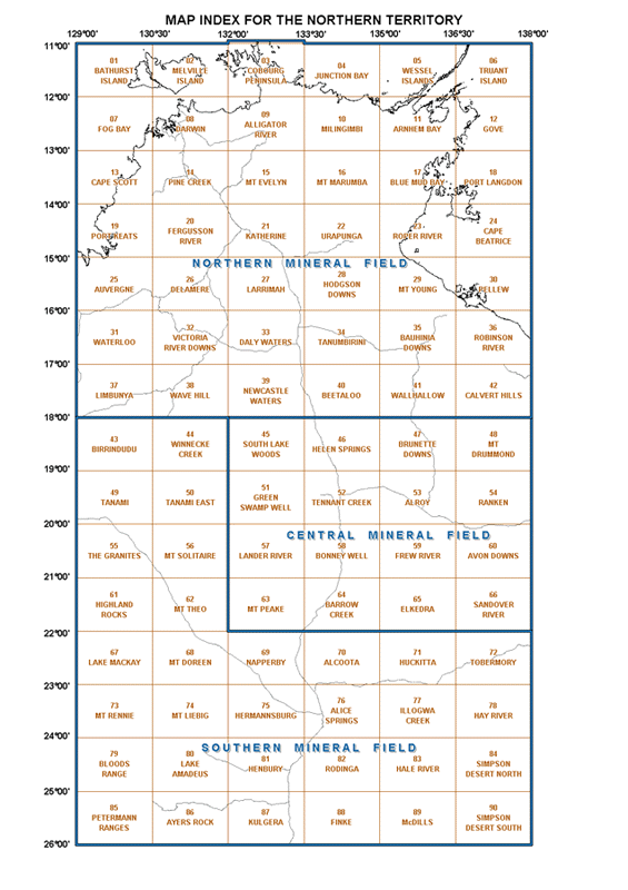
To start exploring these historical maps, click on the NT Map below. Read below for an explanation of how to use them.
For current granted mineral titles or applications for all mineral titles, go to the STRIKE website.
How to use the maps
As you cannot search for individual titles on these images, you will need to have some geographic knowledge, or a general area of interest, before you start.
Before you access the map images by clicking on the above NT map, read the following information.
After selecting the map that you are interested in, you will be presented with a table, listing the available images for that region similar to example one below.
Example one
Recommended method for a quick view of the images.

This option will enable the browser of your computer to view the images, and will enable you to pan around and zoom into an area of your interest.
To pan, hold down the left mouse button and drag the image. To zoom in, hold down both the left and right mouse buttons at the same time and move the mouse forward (as if moving the pointer on the monitor upwards).
To zoom out, hold down both the left and right mouse buttons at the same time and move the mouse backwards (as if moving the pointer on the monitor downwards).
Map scale
The 'x' indicates the scale of the map captured in the image (see above example).
Example two

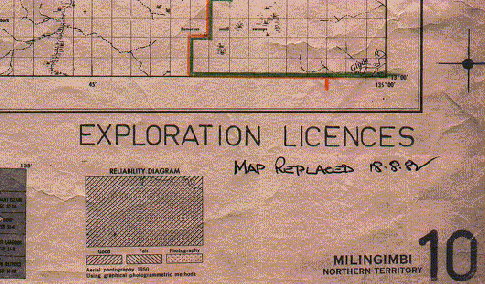
In the above examples, the image that will be loaded, will be of a map at 1:250 000 scale.
The date "18/08/1982" appears on the map image meaning that this map was updated from 18 August 1982.
Date
The purpose of the date field is to give an approximate chronological order to the maps that are available in the area of your interest.
This date reflects one of the following 3 possibilities:
- If the date, shown in the date field, appears on the map image then the map was put into service on that date.
- This is the typical case.
- If the date, shown in the date field, does not appear on the map image, then the map was updated to that date.
- The date was taken from the back of the original paper map which was placed there by archiving staff.
- This may be the case on some maps dating around the 1960 to the 1970s.
- If the date field is blank, then the paper map was not marked with either of the previously mentioned dates.
- These maps generally would be dating around the 1960 to the 1970s.
Contact
If you have any questions, contact the relevant branch.

